Saturday 8/2: Hiking to Shadow Lake
So Saturday morning dawned bright and sunny. We had a nice leisurely breakfast with the other folks in camp, but couldn't convince any of the rest of to join us. The plan was to hike 3.5 miles up to Shadow lake and back. We had some thought that if we were feeling good and making good time (since we didn't get started until 11am) that we might continue on to Lake Ediza a bit further along and a bit further up.
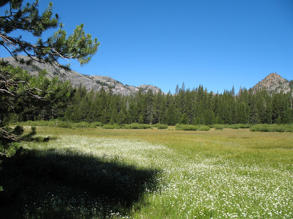
This is the meadow at the start of the hike - the mountains we were hiking into would be just a bit farther left in this photo.
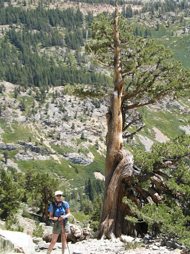
About 4-5 years ago I started hiking with poles. I found that they were a great help with my balance - especially with things like crossing rivers, and that it let me take some pressure off my legs both going up and down hill.
The hike to Shadow Lake has three distinct stages it starts out at about 8200ft, goes relatively flat for about 1 mile, drops to 8000ft over about .5 a mile, goes flat for .75 mile or so, and then goes up up up to 8700ft in the last 1.25 mile or so.
Since I knew that there was going to be a lot of up (and therefore also a lot of down, I opted to bring my sticks. You can see me and my poles (and some gorgeous scenery) below:
By the time we got to shadow two hours later I was feeling tired, but not 'done'. The climb from the bottom of the valley to shadow had been harder than I felt it should be given my gains in strength and endurance, and our pace (my pace really, since Daniel is a born billy goat) had slowed considerably.
We spent a lovely few minutes on a large sun warmed rock jutting out into the lake. Refueled a bit, rested a bit, stretched a bit. I have to say that the weather was absolutely perfect, and as long as you were in the sun, there was a pleasant lack of mosquitoes and flies.
We consulted the map, and it looked like Lake Ediza was about 2 miles further on - and only 500ft further elevation gain, so I decided that I'd like to push on for that (It was never a question for Daniel ;-) ). Since there wasn't going to be a lot of 'up' for the rest of the hike, and because I was starting to feel like they were at least as much of a hindrance as a help, I decided to put my hiking sticks away for the rest of the trip to Ediza and back - fully expecting to pull them out to descend from Shadow.
To my great pleasure, I discovered that I was much faster without them, not only on the flat parts but also going up and coming down hill. Daniel said it was like I had taken my training wheels off. LOL - and it actually felt a lot like that. The strength and endurance I have gained with CF finally made the appearance I was expecting it to. I was definitely faster and stronger and nimbler than I have ever been hiking. It was so much fun!
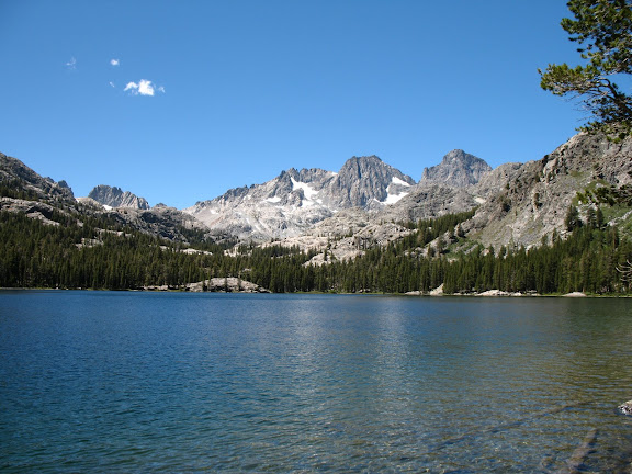
We got to Ediza around 2:30 - turns out it's closer to 2.5 miles than 2.
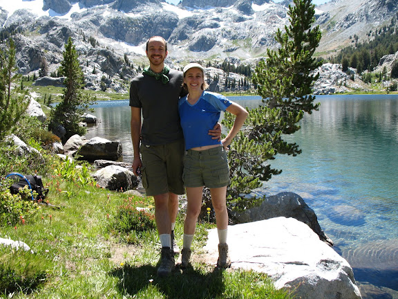
Once we got there we did some burpees (after all it WAS day 20 of the burpee challenge and where better to do them than near a beautiful alpine lake) and had lunch.
The first set of Burpees is @ Lake Ediza - the second is on our return to Shadow lake. You'll notice a slight camera shake in Daniel's set of burpees @ Shadow Lake - the photographer was attacked by a bug ....
Part way back down to Shadow from Ediza I started developing a headache. :-( I tried fending it off with food and plenty of water, but it was getting pretty insistent by the time we reached shadow. I tried adding Ibuprofen and electrolyte tablets to the mix once we stopped and rested (and did more burpees), and they kept the headache more or less at bay until we got back to camp, but it quickly bloomed into a full-fledged migraine. It was a bummer of a way to end a day that had gone so well and been such a personal triumph.
It had taken Daniel and me 2 hours to reach Shadow lake on the way up, with me using my poles. On the way back down - and pole-less, it only took an hour and a half. We were concerned about the possibility of missing dinner, so Daniel was setting a pretty fast pace on the way home - but I was able to keep up the whole way back. Our GPS device shows a little pause sign every time we stopped to take a rest - and the only pause between shadow and the end of the trail was when we came to an unfamiliar turn off in the trail and had to stop to figure out which way to go. This was not a pace I ever could have maintained at the end of a 12 mile hike - with (some) energy to spare at the end of it - a year ago.
If you click on the picture below, you'll get a link to the GPS data from our hike. you can view the basic info with Firefox or IE, but the Map Player function only works in IE. You can choose your background in the Map Player, and I think the most interesting one is the topo.

And here is a link to the rest of our photos from the trip:
http://www.facebook.com/album.php?aid=48056&id=713406614&ref=mfMy headache didn't really subside until we got home. Daniel was an absolute hero and drove the entire 6 hours home and let me sleep, which apparently was just what my headache wanted to make it go away. But it definitely put a sour note at the end of an otherwise very enjoyable, very successful camping trip. Having had such a nice respite from my day-to-day grind sure made it hard to go back to work today (Monday).

 I have never been an athletic person, nor a particularly healthy person. When becoming healthier became a goal of Daniel's I realized that I very much wanted to join him on that journey. I have some specific obstacles to overcome to realize those goals, but I am loving the results so far, and am excited to see how far I can get with dedication and perseverance. This blog will help me record the Journey so that I can look back to see how far I've come.


 When I turned 30, I took stock of myself and was not very impressed with what I had become physically. I resolved to lose weight and get fit, and spent the next year and a half doing just that. In that journey I've discovered Crossfit and Rockclimbing, and am now passionate about them both. This is a log of my progress.